|
 |
MAPS |
MIRIAM WEINER MAP COLLECTION
1. JOINT OPERATIONS GRAPHIC (JOG) MAPS
Part of a numbered series of Joint Operations Graphic (JOG) maps produced by the
US Department of Defense Aeronautical Chart and Information Center during the 1960s.
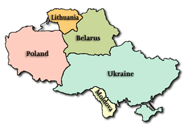
The maps cover Belarus, Poland, Lithuania, Ukraine, Moldova (formerly Bessarabia), Romania (partial) and Hungary (partial).
The original paper maps were scaled at 1:250,000 including names and details of even small villages,
plus roads and railways, rivers and lakes, and wooded areas. Borders between administrative
districts in effect at the time are also marked. Topography is indicated by color bands and contour lines.
Each map is identified by the name of a large town on the map. I have added names of smaller towns
to assist you in locating your town of interest.
Click HERE to see these map lists
2. TOWN AND REGION MAPS
a) Various Local Maps
During 25+ years of traveling in Belarus, Lithuania, Moldova, Poland and
Ukraine, I have acquired a significant number of detailed “town” maps from
various localities, including small towns and villages. Many of these maps were
produced by the local town architect and given to me as a “present” by the
local Mayor. Others were presented to me by various historians and archivists
in the relevant countries. Sometimes, I acquired a map in preparation for an
upcoming “customized tour” planned for the family of a research client. In
those cases, I created a small handwritten legend in the side margin of the map
detailing the location of the Jewish cemetery, synagogue, Holocaust
monuments and former Jewish sites, where applicable.
Click HERE to see these map lists
b) Soviet Town Plans
This collection consists of street maps of individual towns and cities within the current borders
of Belarus, Latvia, Lithuania, Moldova, Poland, Romania and Ukraine. Each town name consists of
1-6 separate maps. The maps are in color and about half of them include a "legend" – primarily an
alphabetical listing of street names. The maps are in the Russian language (Cyrillic alphabet).
There are
maps in this collection, with more to be added shortly.
Click HERE to see these map lists
3. HOLOCAUST MAPS
This section includes many maps from Sir Martin Gilbert's books with accompanying text from the
U.S. Holocaust Memorial Museum in Washington, D.C. These links are to the actual pages in my
books, "Jewish Roots in Ukraine and Moldova" and "Jewish Roots in Poland" or from this website.
This section also includes detailed World War II maps for both Krakow and Warsaw.
Click HERE to see these map lists
4. ADDITIONAL MAPS FOR:
POLAND, UKRAINE, AND MOLDOVA (from Miriam's two books)
BELARUS AND LITHUANIA (that appear on this website)
Click on relevant country above to see these maps links.
5. CREDITS
As usual, there is a team who facilitates this and "makes it happen." My
continued respect, admiration and gratitude for team members goes to
Jay Osborn who handled image processing, tiling, and map decorations,
using
MapTiler and
OpenLayers code; Jay was assisted by
Vasyl Yuzyshyn
(from Lviv), and together, they created these maps along with the
helpful links for the Belarus town maps; and as always, I am grateful to
Stephen P. Morse, who wrote and executed the necessary script to do
the transfer -- in addition to my usual "tweaking" requests.